THE WHYS, WHATS AND HOWS
This will be my twelfth walk in nine years in the British Isles, beginning when I found a used copy of Wainwright’s Coast to Coast book in a shop in Salisbury when I was 65 years old. I’ve never regretted spending the £2 on that iconic book. My wife Cathryn and I live north of San Francisco. She has accompanied me twice, on trips to northern Ireland and northern Wales, but never walking. Once, she took Irish language classes while I took a weeks class in Irish hillwalking. Then, she took Wales mythology classes near Llanberis while I set out for day walks over the tops of Snowden, the Glyders and Cadir Idris. But what I love more than anything are the long distance walks of over 200 miles. This walk is one of those.
A bit unconventional some would say, this walk, like my last two in England, connects parts of national trails and established paths over high places that I have not yet walked. The first part of my walk will be a redo of my Dales Way walk seven years ago but, this time, I’ll go off course toward the heights of Pen y Gant and Ingleborough, then rejoin the Dales Way at Cowgill (see map). I'll also include part of the connector path from Leeds to the Dales Way beginning at Ilkley.
After my first DW walk, I spent time in Ambleside and Coniston getting acquainted with nearby mountains. On this walk, after the DW, I’ll be on a circular walk in the Lake District from Troutbeck to Patterdale to Elterwater to Wasdale Head to Rosthwaite and back to Troutback. I’ll try to touch as many high places on the way as the weather and my protesting body will allow.
To finish off, I plan three days on the Pennine Way from Edale to Hebden Bridge to help fill in parts of the Pennine Way that I have missed. All my accommodations and trains have been booked in advance so I had better finish each day’s walk, one way or another. The map below shows the standard Dales Way walk.
To finish off, I plan three days on the Pennine Way from Edale to Hebden Bridge to help fill in parts of the Pennine Way that I have missed. All my accommodations and trains have been booked in advance so I had better finish each day’s walk, one way or another. The map below shows the standard Dales Way walk.

PART 1: A DALES WAY WALK
After my overnight flight from San Francisco, the customs line at Heathrow took only five minutes. Via the tube, I was in Kings Cross train station by 8:30, in time for a Starbucks coffee before my pre booked train to Leeds.
The recent KingsX station remodel was impressive, plus they added a brick walled 9 1/2 platform to the delight of Harry Potter fans. Teenagers love to have their photo taken in front of the bricks. I’m a fan too so I thought it was a cool idea.

Newly Remodeled Kings Cross Station
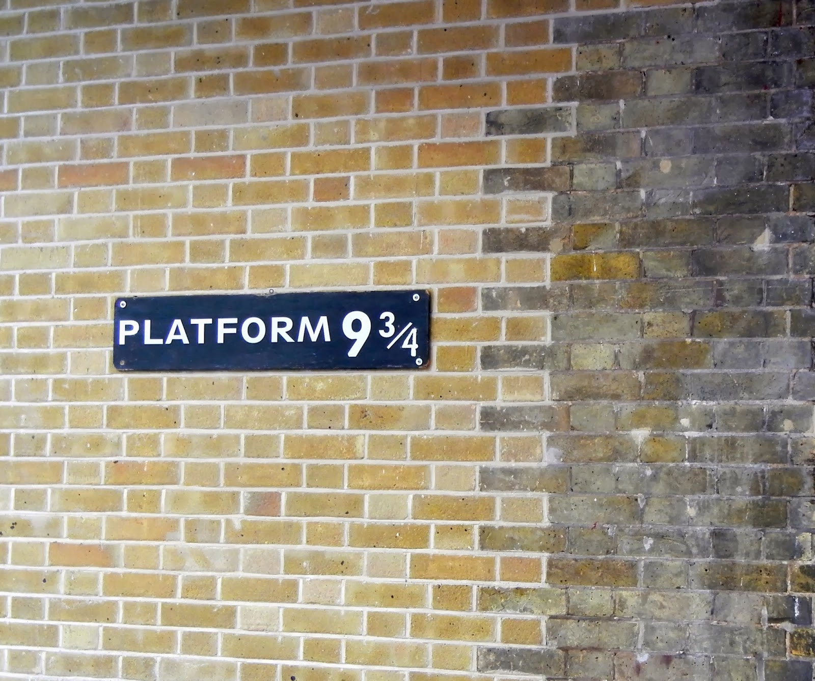
9 1/2 Platform For Hogwarts Train
On the train to Leeds, I put a UK Sim card in my unlocked mobile but it didn’t seem to work. I found an O2 phone store in Leeds to get help; the phone was actually working but the volume was turned too low for me to hear anything. Corrected, thanks O2, but I felt rather foolish.
I’m walking the Dales Way connector to Ilkley so my first overnight will be in Menston, partway to Ilkley. It’s a little far for me to walk today in a reasonable time so I took a bus to Bramhope. From there, I hope to have an interesting walk along the Chevin ridge to Menston. It’s been raining quite a bit; everywhere I look is sloshy and muddy, especially the sheep pastures.


Cheerful Chili Pub - Love The Name
The DW track onto the south part of the Chevin (Miller Lane) is a fast flowing stream along muddy ruts, so I opt for the nearby road until I reach the Surprise car park below the Chevin ridge. Up on the ridge are beautiful crag rocks, a huge cross and a directional beacon monument. The site overlooks (surprise) both Otley to the east and Menston to the north. Rain clouds are everywhere but the rain has finally stopped.

I follow the ridge awhile, then, as I approach Menston, I drop down to my lodging, Chevin Guest House near the Chevin Pub. Anne put me in a nice new room with a fabulous shower, very welcome after my long flight from San Francisco and the rainy trek today. By 18:00, I was ready for dinner at the pub. They had a two course special; haddock in mushroom sauce and winter vegetables in puff pastry with roasted red pepper sauce. Both were superb, washed down with a pint of Wharfdale Slinger Ale. I was in bed and asleep by 20:00.
Friday April 20 Menston to Embsay 18 miles

A Very Inviting B&B
 Busy B&B Patio
I met a group of teenage girls going to Ilkley but they were actually headed toward Menston. I turned them around and said “Follow me,” I left them behind when one girl with a huge pack couldn’t get through a kissing gate among shrieks of laughter. That was a picture I shouldn’t have missed.
 On Burley Moor Path
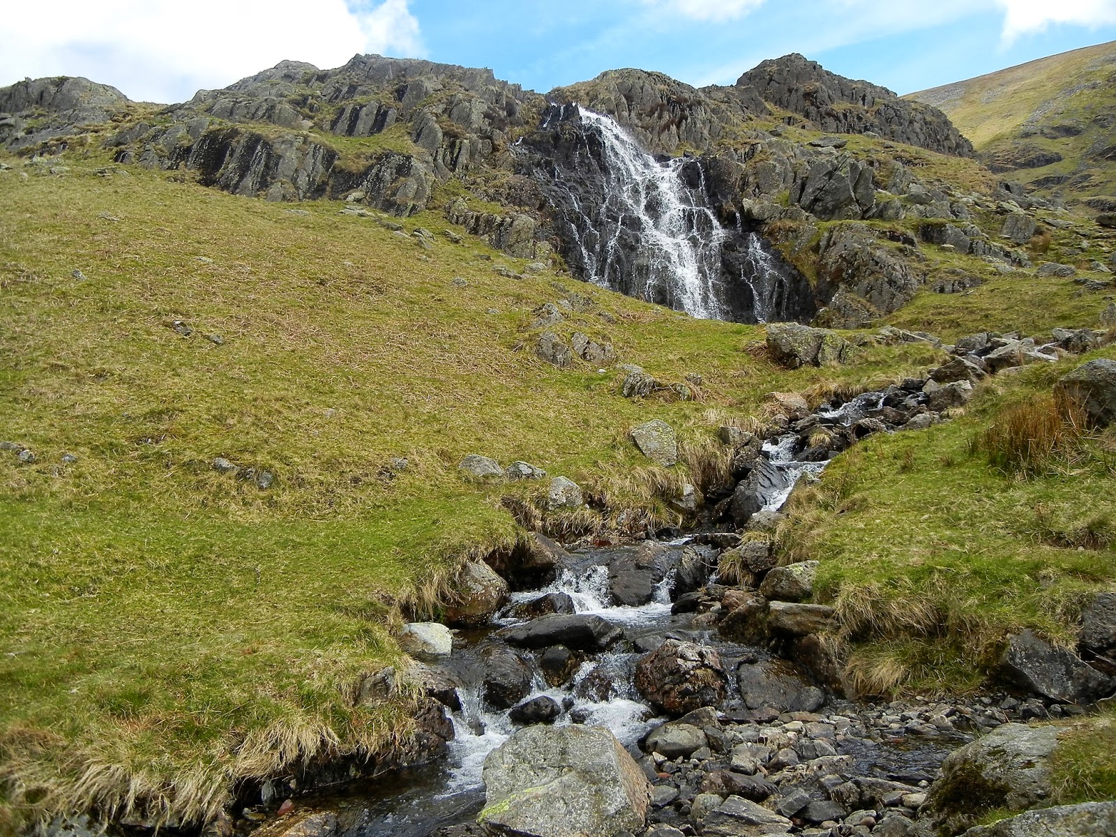
No rain today but very muddy underfoot. There were spectacular views up on Burley Moor, then Ilkley Moor. Vegetation are heather and bilberry but not much color this time of year. I passed under Pancake Stone, then the rough grouping of Cow & Calf rocks next to a rock cliff and overlooking the Cow & Calf Inn below on the road. Starting the descent to Ilkley, there was a high waterfall at the head of a ravine.

Pancake Stone

Rock Cliff Near Cow and Calf

Ravine and Waterfall
Ilkley is a pretty town with some fine houses and lucious flower plantings on the way to town center. Among the town’s hustle and bustle, I stopped at a Gregg’s Bakery for a Yorkshire tart and ate it with a sausage and roll saved from breakfast as I sat along the Wharf River near Ilkley Bridge.
 Ilkley Bridge

Duck Family Crossing the Road
On to Addingham following the path beside the river, then to Bolton Bridge. Before reaching the bridge, a heavy rain began so I put my Duck’s Back cover on my pack. A portion of the DW was on a road with no verge - scary! How did the Ramblers let that happen? It was raining hard so I went into the tea room at the Bolton Abbey Hotel complex. My B&B for the evening is in Embsay, a little west of the Dales Way. I was hoping to take the short train ride to Embsay but there is no train or bus today so I had a pot of tea and dried out a little bit, waiting out the rain. It was only four miles to Embsay so when the rain stopped I was off on trails and byways to Embsay and my lodging, Rockwood House. It is a very nice B&B and also it is just across from the Elm Tree Inn, the best pub in town.
After cleaning up, I went over to the pub and tried the local Copper Dragon ale (made in nearby Skipton) but was a little disappointed. Next I had the Bombadier ale which was excellent. I ate some superb stir-fried vegetables in black bean sauce with chicken and rice, then a sticky toffee pudding with ice cream. It was a nice crowd, friendly people, talked to at least half a dozen. At an adjacent table, Sally and friends were celebrating a birthday with a bowl of chips each and a cigarette lighter posing as a birthday candle. It was hilarious, all having loads of fun.
After a fine breakfast, my B&B host Jeanne drove me the four miles back to Bolton Abbey to resume my walk. The Abbey was unchanged from when I saw it seven years ago with ducks and daffodils setting the scene. As I made my way upriver, families and cyclists were gathered at Cavendish Pavilion refreshing themselves with tea and pastries and making use of the restrooms.

Bolton Abbey
Further along the River Wharf, I was disappointed to find the famous Strid limestone formations submerged under high water. On my last walk here, it was fully exposed and very impressive. Mallards are flying everywhere on the river looking for morning treats.

The Strid
I passed by a fine ancient water aqueduct/footbridge that I didn’t remember from last time. Up on a hillside was the ruined Bardon Tower, a hunting lodge of the Cliffords of Skipton Castle in the 16th & 17th C. Lady Anne
spent her last years here; d.1676. I love the occasional footbridge spanning creeks emptying into the river.

Footbridge Across Creek At River Wharf
After Burnsall is a suspension bridge gaining access to the east side of the river and a fine riverside walk shaded by ancient trees, the path covered with a spiderweb of roots. Below Grassington, I walked over the Grassington Bridge to get the view down river across to Linton. In Grassington, the tourist season seems to have started; the village is crawling with visitors. But this is a weekend, isn’t it?
After Burnsall is a suspension bridge gaining access to the east side of the river and a fine riverside walk shaded by ancient trees, the path covered with a spiderweb of roots. Below Grassington, I walked over the Grassington Bridge to get the view down river across to Linton. In Grassington, the tourist season seems to have started; the village is crawling with visitors. But this is a weekend, isn’t it?

Suspension Foot Bridge

View From Hills Above Grassington
On the path above Grassington on the way to Kettlewell, all is peaceful again but rain clouds fill the sky. Several lonely walkers pass me on their way to Grassington. I see spectacular limestone karsts on the hillsides both right and left. Sheep are guarding the entrance to a disused kiln. What do they have hidden in there?
 Limestone Karsts

Sheep Guarding Disused Kiln
Rain began about 15:00, off and on till evening. Near Kettlewell, lambs cover the fields; cute little fuzz balls, two per mommy sheep fighting over the milk, never mind the rain. In Kettlewell, the hostel tried to put me in a four double bunk room, all the lower bunks taken. I told the warden I have a hard time with upper bunks and needed a lower one. She had a female room but no females that night so, bless her soul, she gave me the key. It was a nice big room with wash basin, I could spread out. Toilet and shower just across the hall, could not ask for more in a hostel. It’s still raining a bit outside.
I passed on the hostel dinner and went to the Kings Head Pub with it’s large blazing fireplace and great atmosphere. I had a vegetable lasagna, salad and Black Sheep Bitters. It was a friendly place, several cyclists, talking to people across tables.
I walk to Horton-In-Ribblesdale tomorrow but which path? I would love to go on the ridge top but it may be too wet. Otherwise, I can follow the Dales Way to Yokenthwaite, then up onto the ridge to Horse Head Summit. Hopefully, from there down to Littondale and Hatton Gill. Then I'd like to go up over Plover Hill and Pen y Gant, but that depends on time and the weather.
Sunday April 22 Kettlewell to Horton 16 miles

Rainy Morning in Kettlewell


Path Along River Wharf
It’s raining again at Hubberhome. A tourist and I are longing to inspect the inside of the church but services are being held and we don’t want to interrupt. I wander among the old cemetery gravestones, soaking in history of the past.

Hubberhome Church

Hubblehome Cemetery
This part of the river is particularly wild and beautiful with limestone slabs and outcrops creating tumbling rapids. The river is narrower here giving, on the one hand, a sense of anticipation and, on the other, a sense of isolation and peacefulness.

Path Along the River Wharf

Limestone and Rapids on the Wharf
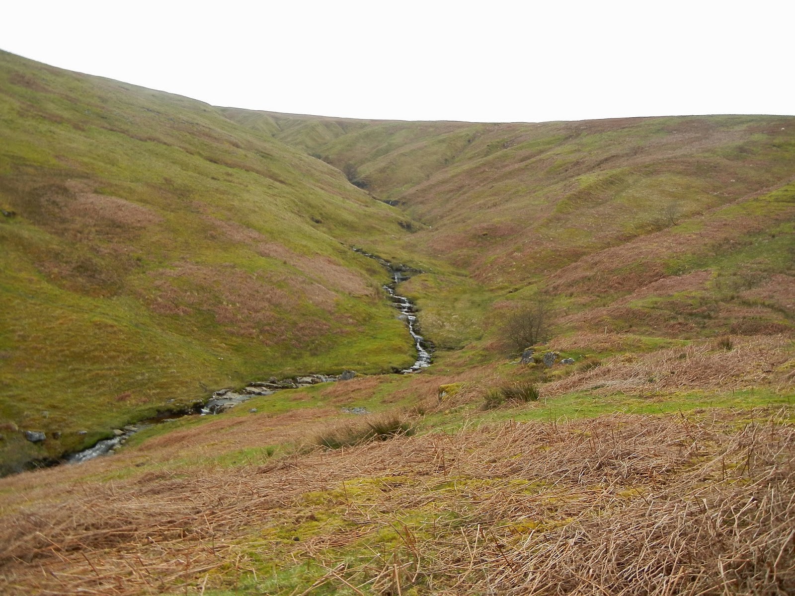
At Yokenthwaite, I eat a bite sitting on a large boulder, cross the bridge to Raisgill and begin the long climb to the ridge top and Horse Head summit. The climb is muddy and arduous but the geological layers of stone and soil on the adjacent cliffs are fascinating. On the ridge, I hike the short distance to the Horse Head trig point marking the summit. Elevation is over 600 m and I can see clearly in every direction even though clouds are swooping by.
Climbing Up To The Ridge

It’s a tiring, steep descent to Foxup where the trail up the side of Plover Hill begins. It took a bit of detective work to find the trail sign, then more navigational sleuthing to follow the very indistinct path with options at every point.

Hatton Gill and Littondale
 Stream Crossing Beside Plover Hill

High up on the side of Plover Hill I find the path that leads onto the summit but, with time slipping away, I decide to follow the trail along the face of the hill. No way marks to follow and I keep wondering if I’m on the right path. It turns out I did take a wrong turn but, after a little more mud than I wanted, I soon righted myself and found the main path from Pen y Gant to Horton.
I was sorry to miss the tops but glad to settle in at the Golden Lion Inn in good time. Rooms are mediocre but decent as befits an old but stately pub. After a great plate of Chicken Tikka Masala w/salad, a pint of Timothy Taylor Landlord’s and good conversation with Pennine Way walkers, I went to my room to regroup for the next day’s walk over Ingleborough.
I had breakfast with some Pennine Way walkers that I met at dinner, a group of five. I left at 9:30 for the five mile climb up Ingleborough. On the trail, I met a hardy group who had an early start from Ribblesdale. I passed over some extensive and beautiful limestone formations that I remember from my Dales High Way walk last year, then more limestone. The trail ran in a narrow muddy ditch within the limestone, hard to navigate, so I climbed on top of the pavement to hop across the dry karst.


The path uphill was very steep and rocky as I met a fell (hillside)l runner coming down. Further up, a herd of sheep, frightened of me, ran from the hill side onto the path then bounded up ahead of me. I felt like a Pied Piper of sheep in reverse. All of a sudden, they bolted off the path as a girl and dog came running down - the sheep had got themselves in a pincher grip and panicked at sight of the dog bearing down on them and me on their tail.
 Track To Ingleborough

Mountain Geology

Closer To The Summit
Near the top, slab steps steeply led to a cold and windy summit. There was no one at the trig point and it was so cold I didn’t stay long, just long enough for a photo and to check out the 4-point wind shelter.

As I turned to move off the summit, the sun disappeared, weather turned dark and even colder. I met two walkers, one was wearing a tank top and was beet red all over. Young and foolish? I took the path down off the north side. I was a vertical path, stone slabs set on edge to facilitate the steep gradient - very scary. At the bottom, limestone slabs crossed the bogs to Chapel-le-Dale.

Descent Off Ingleborough

Across The Bogs On Limestone Slabs
Like yesterday, I began feeling the press of time and energy that it would take to finish the day’s walk to Dent. I had a backup plan, so I hurried over to Ribblesdale Station just in time to catch the 14:05 train to Dent Station. This move would save an hour. From Dent Station (highest station on the Settle-Carlisle Line), a quick walk downhill to Cowgills where I met the Dales Way again. It will be an easy two hour walk from here to Dent mostly along the River Dee.

Crossing The River Dee

House Guardian In Dent
I reached Dent and the Sun Inn at 17:00. This has become a regular thing for me the last few days although I would prefer to arrive 1/2 hr or 1 hr earlier. I stopped at the little store in Dent to stock up on energizing chocolate, a Cadbury’s bar and a Snickers. I’ll need them for tomorrow’s walk. Sun Inn is nice and friendly, iconic even, a place I’ve always wanted to stay. I’ve walked through Dent twice before but each time staying in Ribblesdale and Sedburgh.
I had a good rump steak for dinner with loads of new potatoes, carrots, broccoli and mushrooms. The beer was a new one for me, Titanic. I liked it very much. At dinner, I talked with a three generation family from Norfolk, spending a week walking the area. They seem to go to a different area every year. At the bar, I talked with an interesting local retiree. He was rather sad. His girl friend had just moved to Montana. He thought it might be a good excuse to visit the USA. I told him he would like Montana.
Tuesday April 24 Dent to Patton Bridge 16 miles
I had breakfast with five Harley motorcycle guys, really BIG guys but also really nice guys. I was able to get on the road by 9:00, following the river past Barth Bridge to cross the Dee on a footbridge at Brackensgill.

Along The River Dee

Curious Youngsters
On climbing over the hill to Sedburgh, I left Dentdale for Garsdale and the River Rawthey. I bypassed Sedburgh, turned upriver and came to the disused iron railroad bridge that I so admire. Seven years ago, I foolishly got lost crossing the fields to Lincoln’s Inn Bridge. I then passed under that wonderful, disused Lune viaduct, always spectacular, high over the River Lune.

Railroad Viaduct Across River Lune
Bridge after bridge on this route. Next was the unusual, curvy, 500 year old Crook of the Lune bridge. Yes, I’ve been following the Lune River since Lincoln Inn Bridge.

Crook Of The Lune Bridge
Just up from the Crook of the Lune bridge is the spectacular Lowgill RR viaduct with two small packhorse bridges underneath. I climb up on the road above, overlooking the long span.

Disused Lowgill RR Viaduct
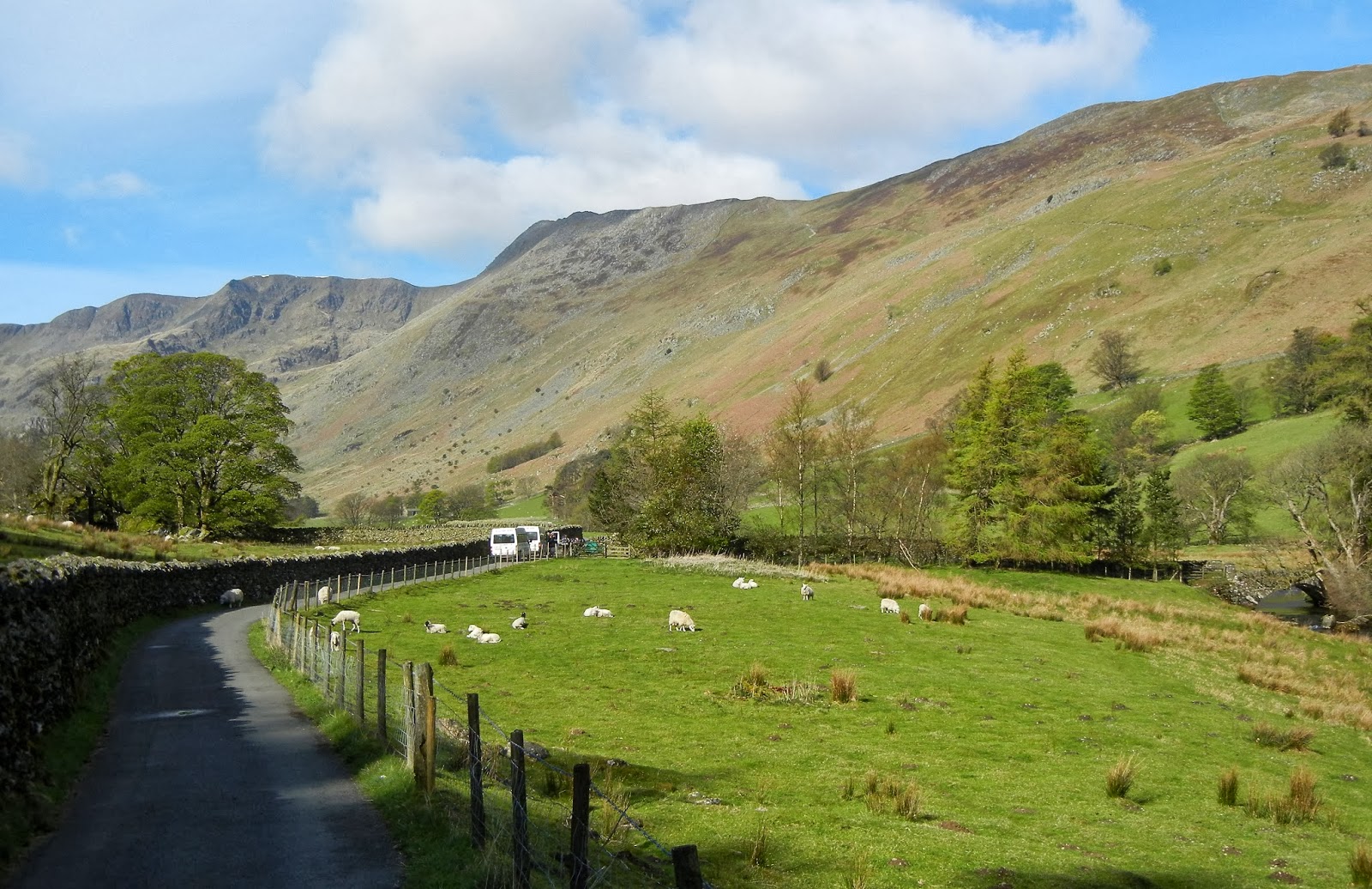
I crossed the M6, then over hill and dale negotiating very muddy paths. No rain today, but past rains have wreaked havoc with the paths. I eventually reached the hamlet of Patton Bridge but couldn’t find my B&B. I called for directions and found Crook Howe was about 15 minutes up a side road at the head of a tarn, a beautiful location. Another 17:00 arrival for me.
Linda put me in a new holiday cottage. It even had a washing machine, perfect timing to replenish my small backpack with clean clothes. Linda fed me a nice dinner of vegetable soup, steak and kidney pie, vegetables and apple crumble with ice cream. Best of all, I had two glasses of white wine. One problem though. Linda is the daughter minding the place while her parents are away and doesn’t know how to coordinate the two TV remotes. This is the third night without TV. I don’t really mind, but it is nice to get the news and weather occasionally.
Wednesday April 25 Patton Bridge to Windermere 16 miles
After breakfast, Linda was going into Kendall shopping so she gave me a ride up to the top of the hill where the Dales Way crosses the road to Big Lands House. I passed by cute little Black Moss Tarn, then across hills and over lanes and tracks to Sprint Mill on the Sprint River. This looked like an untouched relic of the 19th century. First, I saw ferocious rapids in the river then, a few feet further, lazy ducks swimming in calm water as I looked across from the far bank among pine and sycamore trees. Today the rain has been off and on but not bad considering the alternative.
Black Moss Tarn

Sprint Mill
I bypassed Burnside and followed the River Kent all the way to Staveley. There was an impressive old stone and wooden building with slotted windows and gate posts across the path. I scrutinized that building closely but its purpose eluded me.

Old Gateposts Along River Kent
From Staveley, a long uphill, a downhill, then up again on lanes and across farms to School Knott Tarn near Bowness. Here I could divert to Windermere, a short distance, but I wanted to finish the Dales Way at Bowness, another two miles. Uh-oh, I’m out of water but not far to go.

School Knott Tarn


Dales Way Bench and View of Bowness
Finally I reach the famous Dales Way Bench, marking the end of the Dales Way, overlooking Bowness and Lake Windermere. I walked down through chi-chi Bowness and over to the Windermere bus and train station. My lodging tonight is the YHA near Troutbeck (strangely named Windermere Hostel) so I took the bus several miles to Troutbeck Bridge and walked the very beautiful, quiet lane up to the hostel, only about 15 minutes.
 View Towards High Street On Way To Hostel

The lane is bounded by mature trees and secluded estates. Off to the right are the mountainous beginnings of High Street which is the southern end of the old Roman road stretching northward into Westmorland and beyond. My plan is to follow it tomorrow but it all depends on the weather which doesn’t look good. Last year, I did that walk up to the summit of High Street when it was rainy, cold and so foggy I couldn’t see two feet in front of me. I don’t want to repeat that experience.

Windermere Youth Hostel
The hostel building is interesting, formally called High Cross Castle, unusual in that it is built of cast concrete. Very friendly staff, a pleasant dining room and a nice bunk room. The southwest corner of the dining room is the only place I can get a mobile signal. I check in at home with Cathryn and we have a nice chat. She is always concerned about my well-being. Well, tonight I’m being fed well with a 3-course meal, broccoli soup, baked fish and my favorite dessert, hot sticky toffee pudding with ice cream. Plus I’m drinking lots of water to get rehydrated after running out today.
My two bunkmates are walking the Coast-to Coast but had to delay their walk due to high winds and heavy rain. With the Ambleside hostel full, they got diverted here and are now plotting their next move. Tomorrow will be bad weather again on the tops so I should not walk over High Street to Patterdale. Should I cancel my B&B in Patterdale and just go to Ambleside or Grasmere? But no, buried in the bus schedule I found a bus from Windermere to Patterdale via the Queen's Head Inn (a mile up the road) and Kirkstone Pass. Yes, I have a plan.

PART 2: LAKE DISTRICT MOUNTAIN LOOP
Thursday April 26 Troutbeck to Patterdale 10 miles
My Coast to Coast roommates will bus to Shap today to resume their walk, thereby skipping the grisly weather on both Grisdale Pass and the High Street ridge. I left at 10:00 to walk to Troutbeck Town Head to catch the 11:34 bus to Patterdale. The bottom of Troutbeck, Town End, had a couple places worth a photo as you see.

Town End Welcome

Town End Post Office


Mortal Man Hotel

The top of Troutbeck is called Town Head where the Mortal Man Hotel proudly stands. The lane through Troutbeck runs into the A592 where I find the bus stop at the Queen's Head Hotel. This is a lovely old pub with fireplace and low ceiling beams but quite chic. I had a pot of tea, then went outside to wait for the bus. It didn’t come. After talking with several people, I found out that summer service doesn’t start for a couple of weeks. I felt like a fool for waiting around for nothing. A friendly waitress found out on Google that Patterdale is 8.6 miles and 2 hrs 55 min walking by road. I said “no problem” even though it’s raining and windy. As I gain elevation on the road, the fog on High Street looks very bad indeed, like where I should not be. I didn't like walking the road, but felt I had no choice.

Queens Head Hotel

Rainy View of High Street
Up, up, up to Kirkstone Pass and the Kirkstone Pass Inn. I’m now halfway to Patterdale, all downhill from here. It’s been rainy, windy and very cold so I went into the pub to dry out and warm up. I got a pint of stout, shed my wet jacket and stretched out in front of the fireplace. The pub has the old beam ceilings like the Queen's Head but is rustic and actually more comfortable, great atmosphere, very welcoming to walkers. I was very happy not to have missed this place. There was a small group of friendly people there and the barkeep was quite sociable.

Kirkstone Pass Inn
I talked a bit to a couple who had seen me on the road. Some time after I left, the couple passed me, stopped, and invited me to ride to Patterdale. Rain was still falling so I accepted. They were on a tour around parts of northern England, doing some day walks and had a huge map that covered the whole back of the car so had to clear space for me, very nice people. I had reservations about accepting the ride since the afternoon was still early, I only had four miles to walk and it was all downhill to boot, but I just gave myself up to the moment and accepted my fate.
They let me off at the Patterdale post office/shop at 14:00 where I resupplied myself with energy snacks and fruit. I walked over to my B&B, Grisdale Lodge, a nicely remodeled two story wooden building. The young owners were John, a fell runner and cyclist, and Christine, a tri-athlete. The room was really nice, scrumptious bed and a luxurious shower. Coffee and cookies were in the lounge where I relaxed and read walking magazines.
At 18:00, I went over to the familiar White Lion Inn for dinner. Small crowd tonight, I’m sure because of the weather interfering with walks. I had a Tirryl Ale with Chicken Tikka Masala. The meal was lighter with more vegetables than the same dish at Sun Inn, both excellent in different ways. I had a nice chat with a man I had spoken with earlier in the village store, and I would see him again on this walk. This is my fifth time to pass through Patterdale, a different lodging each time and I would certainly choose Grisdale Lodge again. This is also my fifth time to eat at the White Lion. I find it a very enjoyable place and wouldn’t think of eating anywhere else although, actually, the next pub food is a bit far, several miles away in Glenridding.
Friday April 27 Patterdale to Elterwater 15 miles
A beautiful breakfast in a sunny room, the rains have passed. Hooray! I’ll head up to Grisdale Pass by way of the main valley route. Last year, I climbed the St. Sunday route on the south side of the valley. Year before last, I went over Striding Edge on the north side of the valley. Twice I’ve walked the valley route west to east but this is the first time walking it east to west. It should be a stroll in the park.
Starting Up Grisdale Valley
I passed up two groups of young people (teens), somewhat milling around, not sure about this venture. I give them advice and encouragement and continued on my way. The views of St. Sunday ridge on my left and Striding Edge and Helvelyn far up on my right are not great due to ambivalent clouds hanging around after the turmoil of the last several days. But I’m enjoying the climb up the valley nevertheless because of the spectacular panorama and I get a different viewpoint walking west.

Up Grisdale Valley Towards Striding Edge and Helvelyn
 Looking Back East to St. Sunday Ridge
Suddenly, I’m skirting Grisdale Tarn, passing by the steep little trail that leads onto St. Sunday ridge. I cross over Grisdale Pass, descend slippery stone slabs and negotiate waterfalls and streams as I skirt Tongue Gill on my way down to the tourist village of Grasmere.

Suddenly, I’m skirting Grisdale Tarn, passing by the steep little trail that leads onto St. Sunday ridge. I cross over Grisdale Pass, descend slippery stone slabs and negotiate waterfalls and streams as I skirt Tongue Gill on my way down to the tourist village of Grasmere.
Grisdale Tarn Looking West

Grisdale Tarn Looking East
Before I know it, I am eating a Magnum ice cream bar in the little park in Grasmere. It's almost a tradition for me to get a Magnum from the Co-Op store, always with the dark chocolate coating. I wanted to say hello to Taffy Thomas, the resident storyteller and England’s Story Laureate (you might have seen his storytellers garden in Grasmere) but he was out of town. Too bad! Two years ago, Cathryn and I met him and were invited to the local storyteller’s monthly gathering at Watermill Inn in Ings where Cathryn was the featured teller (like Taffy, she tells professionally) and we all had a wonderful time with such friendly people and hearing the local stories. Forgive me but I have to show Cathryn and Taffy from their meeting in Grasmere.

As I was walking along Grasmere Lake toward Elterwater, I again met the fellow I had talked with in Patterdale. What a surprise! Unusual to meet the same walker three times in 24 hours. I’m actually walking to High Close Hostel just over Red Bank ridge between Grasmere and Elterwater. I arrived an hour before opening time so I made coffee in the kitchen and relaxed with my book. This is a wonderful old building with such a comfortable, picturesque porch. My second time here. I love it.

Overlooking Grasmere From Red Bank


High Close Hostel
I’m put in a large dorm room but I have an alcove that is quite private with a window that looks out over the trees to Ambleside. Dinner is at 19:00, beef stew in a pastry, pure old English. There is a big walking group from Manchester. I made friends with several of them. I’m reading awhile in bed but talked to two policemen participating in a charity event. They have to be on Crinkle Crags at midnight to light the checkpoint for night runners. Every checkpoint has to be lit to show the way. They will sleep all day tomorrow.
Saturday April 28 Langdale Loop Day Walk 8 Miles
A raucous breakfast this morning with several excited walking groups. Today for me is a day walk in the Langdale Pikes above New Dungeon Gyll Hotel, a walk I’ve wanted to do for a long time. I’m walking down to Elterwater to catch the 10:00 bus to Dungeon Gyll, only a fifteen minute ride. I started the climb behind the hotel, following the beck up to Stickle Tarn. A very good path with nice slab steps and natural rock footholds. Great views even with the sun in and out. No rain in sight. I keep looking behind me across Langdale to the Coniston Fells where I walked two years ago.

Climbing Up From New Dungeon Gyll Hotel

Ascending To Stickle Tarn
There is a gathering of climbers at the tarn, some are turning back. I climb up and around the granite wall you see in the photo, then over to Pavey Ark, the first of three peaks. After that, it’s an easy walk over to the highest peak at 736 meters, Harrison Stickle. I've had great views south to the Little Langdales and Lake Windermere.
 Stickle Tarn
 Looking South to Little Langdales

Harrison Stickle Summit

I descended Harrison Stickle and then climbed back up to Pike o’ Stickle, a blunt nosed bullet sticking straight up into the sky. It’s a hard rock scramble to reach the top but the views are the most glorious of all. To the west, I can see a path up to the brutish rock wall of Bowfell and another up Rossett Pass. Scafell, England’s highest mountain, is peeking out in the background with spots of snow. The whole Langdale valley is spread out southeast to Elterwater and beyond with Pike o’ Blisco and BleuTarn to
the south.
the south.

Pike o’ Stickle (see steps leading up)


Pike o’ Stickle Summit Looking South
On advice of a walk guide, I took an alternative path back to Dungeon Gyll Hotel. It was more interesting than the normal path, passing through an ancient axe making area known for it’s sharp edged rock. I reached the hotel at 15:45, an excellent 5 1/4 hour walk. There was time to hear some live Irish music at the hotel pub before the 16:30 bus to Elterwater.
 Bus Stop at Entrance to Dungeon Gyll Hotel

On the bus, I saw some friends from the hostel and we had Coniston Bitters at the Britainnia Inn before walking back up hill to the hostel. For dinner, I had vegetable soup and scampi with salad. Then a quiet night with reading and writing before tucking in for a good sleep.
Sunday April 29 Elterwater to Wasdale Head 15 miles
Today may be interesting. A strong weather system is supposed to hit here about noon so I better cancel plans to go over Bowfell and Scafell Pike today. What a shame, I was really looking forward to it but weather has curiously dogged me this trip. Instead, I’ll take the slightly lower route to Wasdale Head by following the Cumbria Way aways, then going over Rossett Pass to Esk Hause. At that point, I could still climb Scafell if weather allows.
I repeated yesterday’s bus ride out to Dungeon Gyll but stayed to the end of the road at Old Dungeon Gyll Hotel. I jump onto the Cumbria Way along with several other walkers headed north through Rosthwaite. I’ll be in Rosthwaite tomorrow night but that’s a story for tomorrow. Four guys pass me, also going to Wasdale Head. The Cumbria Way track follows Mickleden Beck, a wide shallow flow of water through a valley bounded by Langdale Pikes on the east and Bowfell on the west. Bowfell is a monstrous slab of granite rising to over 900 meters, would not be advisable to climb in poor weather.
At the foot of Stake Pass, I turn west off the Cumbria Way for the climb up to Rossett Pass. The four walkers are already aways up the trail. This is a great climb because the trail steps have been crafted of stone slabs or carefully cut from the natural rock. I have a magnificent view of the trail back down the Mickleden Valley and across the valley to Pike o’ Stickle. Wow, I was actually on top of that yesterday. I can see Harrison Stickle too.


Overlooking Mickleden Valley To Pike o' Stickle

Rossett Pass Summit
After the pass, it was a little way further to Angle Tarn where I spotted the four walkers taking a snack break and rest. They had also planned to climb Scafell but the wind was picking up and rain was starting to fall so, like me, they decided to give it a pass. I ate a banana and a trail bar and decided it was time to put on my pack cover - but I couldn’t find it. What did I do with it? I hadn’t used it since Patterdale. One of the guys had an extra bin bag and generously gave it to me. Quite thoughtful.

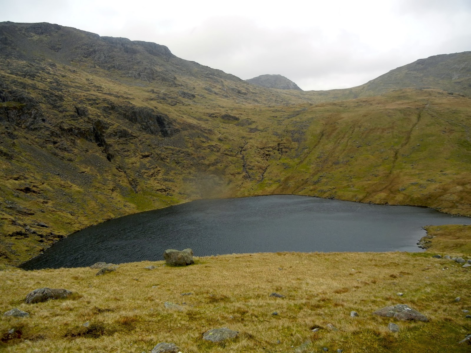
Angle Tarn Looking West (Is that Scafell in the background?)
The guys are walking the Bob Graham Round but not too seriously because of the weather and one of them is having a hard time keeping up. They take off ahead of me and I don’t see them again until the pub in the Wasdale Head Inn where they promised to buy me a pint. There is another climb to Esk Hause at 759 m. The wind is quite strong now with some sleet. I see snow higher up. No thanks, I’m not going there.


Esk Hause
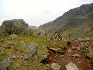
At Esk Hause is a stone wind shelter. A few paths cross here, north along the Glaramara ridge, southwest to Scafell Pike (highest point at 978m), southeast back to Bowfell and my path, northwest to Sty Head where it turns west to Wasdale Head. Still with me? Are you dizzy yet? There are no way marks but I was here two years ago to walk the Glaramara ridge so the place wasn’t new to me. However, I was still a little concerned that I had chosen the right path, a common concern of mine, but my compass pointed the way.
Weather is miserable, rain and cold wind, but, as I descend, the weather eases up a bit. At Sprinkling Tarn, I met a couple coming up from Rosthwaite making a loop walk. Great Gable looms ahead of me. Further on, I reach Sty Head overlooking Sty Tarn exactly where I’m supposed to be. That’s always a relief but there is no relief from the wind. It's worse than ever.

Great Gable From Sprinkling Tarn
I see a walker resting behind a rock wall out of the fierce wind. We walked together around the base of Great Gable negotiating the rocky screes. Two young fellows passed us like they were on a paved road. How do they do it? The wind is behind them! As we rounded Great Gable, I saw Wasdale Head Inn and Wastwater in the distance. Wind was stronger than ever. I had to brace against it with walking poles.


Wasdale Head And Wastwater
 Wasdale Head Inn

From Burnthwaite Farm, it’s an easy stroll to the hotel where they put me in a large, comfortable room. I arrived at 15:35, a five hour walk same as yesterday. With the weather, it seemed longer. I went down to the bar and saw my four walker friends. We talked for 1 1/2 hours, others gathered around, everyone had questions about the US, politics and such. I being a Democrat and fairly liberal, we had a good exchange of ideas. They all seemed intensely interested in what we were doing across the pond.
My friends are actually staying at the hostel at the other end of the lake and have a friend to pick them up. I go up for a shower, put clothes in the drying room and wash socks and underwear. And what did I find in the bottom of my pack? My pack cover! Dinner is a Thai Vegetable Curry w/rice and salad. Earlier, I had a Langdale Ale, now a Yarbarrow Stout, both local and excellent. Back in my room, a little TV, writing and reading. Tomorrow, weather will be much better, I may have a chance to climb Great Gable while retracing my steps on the way to Rosthwaite.
Monday April 30 Wasdale Head to Rosthwaite 15 Miles

Lingmell Beck Looking Back at Wastwater

I think about climbing Great Gable and even go up the path aways to get a closer look at Napes Needle, but decided to turn back. It’s a nice day but the wind looked daunting with clouds whizzing by overhead and I had other ideas. The path parted. My route from yesterday stayed left upward and around Great Gable. I wanted to try the lower path along Lingmell Beck (both end up at Sty Head Pass). I loved this path. The river was exciting and following the path through boulders was a challenge.


Path Along Lingmell Beck


Upper Reaches of Lingmell Beck Near Sty Head
As I climbed with the beck, Scafell revealed itself with spots of snow. Lingmell looms next to me in front of Scafell, Great Gable was as monstrous on my left. I came to the pass with Sty Head Tarn below to the east on the path to Rosthwaite and Borrowdale. A few walkers were coming up from Borrowdale, turning to go up toward Esk Hause. I notice a path coming down from Windy Gap and Green Gable, one of the high route options to Great Gable. The path to Borrowdale follows Sty Head Gill and passes over Stockley Bridge where I stopped for a bite to eat along Grain Gill.

Sty Head Tarn


Stockley Bridge Over Grain Gill


Grain Gill Looking South


A Well Placed Stone
I arrived at the Royal Oak Hotel in Rosthwaite at 14:30, an easy day’s walk which was just what I wanted. Tea and their scrumptious scones w/jam were served at 15:30, a wonderful little benefit for residents. Talked with a couple from Durham; she has a Gregg family name, possible relation with the Gregg’s Bakery family. My first name is an old family name; could it have threads back to northeast England?
After a shower, I went next door to the Scafell Bar which, as I was advised on a previous trip, has a more extensive beer selection than Royal Oak. The bar is large and there are quite a number of coast to coast walkers, several groups that I will walk with or leapfrog on the path tomorrow.
The set dinner at Royal Oak is at 19:30 and there is a full house. They serve sweet potato and vegetable soup, roast lamb with mint sauce, roast whole potatoes and chopped leeks. We finished with ice cream, a selection of cheeses, then coffee and chocolate leaves in the drawing room (lounge). All very proper. I had a nice conversation with about six people, then retired to write, read and get ready for my walk tomorrow back to Grasmere and Troutbeck.

Starting Up Borrowdale From Rosthwaite


C to C Path Looking Down To Borrowdale


C to C Path To Lining Crag and Greenup Edge
At Greenup Edge, everyone seems to lose their bearings in the hills and bogs but I forge ahead and the others follow. At the iron fence posts where the paths divert, I opt for the high ridge route in lieu of Easedale Valley. First, I climb up over Calf Crag then up to Gibson Knott where I stop for a little snack. A girl with two big black dogs came by; she looked familiar. She stopped and said “I know you but I don’t know where I saw you.” Finally we realized it was on the Langdale Pikes three days ago where we spoke. She is a local girl that likes to roam around the high places, always with her dogs.


Helm Crag looking to Grasmere
Helm Crag was an unusual rock formation with a nice view of Grasmere. I reached Grasmere at 15:00, an hour later than expected, so I took the bus all the way to Troutbeck Bridge, then trudged uphill to the hostel. They remembered me.
I have the same room as before but with a bed next to the window. What could be better? After cleanup, dinner was at 19:00 with beef lasagna and salad and a very good Marston Pedigree Ale. Washed socks and put them in the drying room. I talked to two cyclists, one from Germany, the other from Holland. The Dutchman is having a hard time; his flatland bicycle doesn’t have the right gears for these mountains. Well, maybe next time.
PART 3: THREE DAYS ON THE PENNINE WAY
Wednesday May 2 Windermere to Edale by Train
The train was on time, arrived in Manchester at 12:30. I bought the 14:45 ticket to Edale so I could have a couple of hours to walk around. Found a Helly Hanson outdoor shop and a Cotswolds shop, just looking at the gear. Coffee at Picadilly Garden, then back to the station.
I arrived in Edale at 3:30 and checked into the Rambler Inn near the station. I cleaned up, gathered my maps for the next three days and then walked up to the famous Old Nag’s Head to have a pint of Nag’s Head Bitters and check out their menu. The ale was good but the menu looked uninspiring.


The Old Nag’s Head in Edale
Back at the Rambler Inn, dinner was an excellent Spaghetti Bolognese with a pint of ale. I called it a night with the usual writing, reading and TV. Oh, and boning up on Pennine Way route descriptions. However, I won’t worry about finding my way tomorrow because I am meeting a friend for one day’s walk. I met Pete last year at the end of a walk and we hit it off. He lives not far away and has done this walk many times. It is one of his favorites.
Thursday May 3 Edale to Crowden 16 miles

That’s Me At Jacob’s Ladder
On top, sculptured rocks were everywhere, we were walking over huge, flattish stone slabs, a somewhat surreal landscape. We came to Kinder Downfall, a high waterfall with a rainbow at the bottom. It’s at the head of a massive gorge with huge, square cut rocks on the sides. A jumble of slab-like stone spans the top.


Kinder Downfall

Kinder Downfall Gorge At Top
We continued around the edge of flat-topped Kinder, then across peaty moors on a slabbed path. Pete has brought sandwiches and candy bars so we stop several times to refresh ourselves. We crossed A57 at Snake Pass, then down into Devils Dike, a deep, wide furrow in the peat. There are peat hags on both sides but the path in the dike is sandy, wet and rocky as we head toward Bleaklow Head. The whole Bleaklow area is dirty and peaty, the cloughs are messy and its easy to get lost because if you get off path you can go for miles without seeing landmarks. Again, it’s a messy job trudging through this landscape with reddish mud everywhere.


Across the Moor To Bleaklow

According to Pete, the sides of the peat hags are being seeded to try to stabilize the landscape and help prevent microscopic particles from leaching into the water runoff which appears in the reserviors as dirty and smelly water and hard to clean for drinking. We reach the high point of the area, Bleaklow Head, marked by a huge cairn. Eventually we follow a steep sided valley down to Torside Reservior.


Descending To Torside Reservior
Pete has a chart showing 8 1/2 hours from Edale to Hadfield railway station where he will take the train home. We are now at 8 1/4 hrs, so a little behind time. My walking pace doesn't quite match his. After saying our goodbys, Pete leaves on the old railway bed to Hadfield and I cross the dam to Crowden. I call my lodging and find out that Old House B&B is not actually in Crowden as it’s address says but is along the railway bed. So I recross the dam and eventually find the muddy path through woods and field to the B&B. A unwieldy way to get there! Plus, my foot is feeling sore.
My B&B host, James seemed unfriendly, a strange way for a host to act. A couple arrived after me, saying how hard the place was to find. He acted unfriendly to them too. As dark approached, a couple called saying that they didn’t know how far away they were and could be quite late. James said “ok.” At least there was moonlight. After tea, James took me to a pub in Hadfield to eat with two other guests (he charges £2 each way). Nice chaps and it was a good place to eat.
Twin beds totally fill my room. TV doesn’t get a signal, the bed is hard and lumpy and the cover isn’t big enough. This was the most uncomfortable bed I’ve slept in since my month spent in India several years ago. A poor night’s sleep. As you might be able to discern, this B&B was not a good experience. Not recommended!
Friday May 4 Crowden to Littleborough by Train
At Picadilly Station, I checked my pack and went out to roam the big city. My camera battery has run out and I realized I left my plug converter at home so I need to buy one. I was directed to the Pound Shop and found one for one pound (amazing). Because of misunderstanding the accent, I was at first looking for a pawn shop. I looked around the mall for awhile, then back to Picadilly for my pack and to Victoria Station for the Littleborough train. My day ticket gave me access to the Metro Link from Picadilly to Victoria. The Littleborough train leaves at 15:00.
I got off at Smithy Bridge, a short walk to Leighton House. Denise will get me a taxi for 9 in the morning to take me up the hill to the White House Inn where the Pennine Way crosses the road. Tea, shower, arrange maps and charge camera and phone. I walked over to Fayre and Square for dinner. I had a tasty Salmon Vegetable Pasta and Black Sheep Bitters, then ready for my usual bedtime routine. My foot is feeling normal again.
Saturday May 5 Littleborough to Hebden Bridge 10 miles - Train to Leeds
This lodging does not serve breakfast so I go down to the chippy. Oops, it’s a bank holiday so it opens late. I opt for an egg sandwich at the convenience store, coffee made in the room. Taxi is on time and takes me to the Pennine Way. This is high up on the moor where the PW crosses the A58 road at the White House Inn. I walk past several reservoirs, then on slabs across peaty moors on the way to Stoodley Pike.
I passed over Coldwell Hill and Bald Scout Hill, crossed the Calderdale Way at Withins Gate, and there stood Stoodley Pike, a 125 ft monument to peace prompted by the defeat of Napoleon in 1814. Now it is blackened by age and soot, best seen from afar.


Stoodley Pike - High And Lonely


A Monument For The Ages
From here, it’s all downhill to Hebden Bridge. The PW follows a beck into the lush Callis Wood area with a variety of trees and beautiful flowers. Just past Foster’s Stone, I turn off the PW onto a path crossing the beck on a packhorse bridge. A family is picnicking along the beck and I stop for a snack before continuing on this shortcut to Hebden Bridge. The track continues along a lane to a bridge over a canal and into the center of Hebden Bridge. The walk was only 4 hours.

I stopped at a cafe for a hot panini and tea, then caught the train to Leeds. I checked into the Metropole at 15:00. I’ve always wanted to stay here in this marvelous art deco building . A wedding reception was just ending, or was it getting started? Fancy dressed ladies stood outside on the steps and in the lobby. I am set up in a nice luxurious room, definitely the best of the trip. The grand old hotel has been totally remodeled sometime recently, probably within the last year.
Out on the town, I called in at Whitlocks for a beer, Old Peculiar. On a Saturday evening it was very crowded. I sat with a friendly fellow and his 90 year old mother. He takes her out every week. Our lively conversation was joined in by four adjacent women, two local and two from France. Later, I went to an Italian restaurant on Briggate, same one I patronized several years ago. I didn’t have Italian food, but a caesar salad and a bowl of mussels steamed in white wine and a glass of red wine.
Summing It Up
Tomorrow I take the morning train to London for my afternoon flight to San Francisco. It’s been a good walk and I had a great time and no physical problems except for a sore foot. I’m sure I over reached on my planning in the high places but I think bad weather and good sense kept my ambitions to a reasonable level. That’s a good thing, to be able to adjust my walk as conditions dictate. As my wife says, it keeps me out of trouble!
I like to sum up my expenses for the trip, lodging and food. Others seem to be interested besides myself. My lodging, including breakfast, for the 17 days was £ 646 ($1034) or £ 38 ($61) per day.
Food and drink came to £ 241 ($385) or £ 14.20 ($22.70) per day. For travel, I spent £ 117.50 ($188) for train bus and taxi fares. I won't try to count my airfare because my ticket was paid with air miles. So the total trip expenses within England came to £ 1004 ($1607). Not bad for 2 1/2 weeks of fun, exercise and social stimulation. I think I'll do it again.
No comments:
Post a Comment